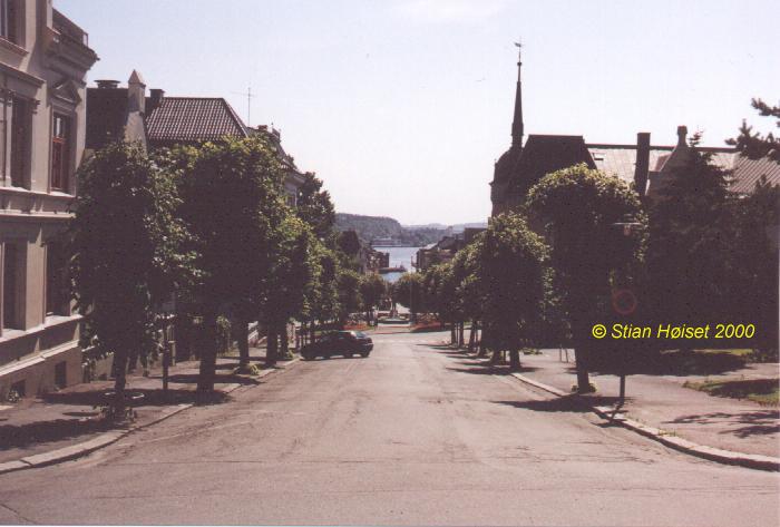
Pictures from Skien; The view southwards from the church

Dette er utsikten sett fra trappa opp til kirken. Vi ser Kirkegata, som går ned til Ibsenparken. Den berømte byaksen går fra uret i kirken til lyktestolpen ved Tollboden, som står på odden vi ser stikker ut i Bryggevannet. Bryggevannet ligger på havnivå, og er bare et annet navn på øverste del av Skienselva. Tårnet til høyre tilhører sparebankbygningen.
Vil du se hvordan denne gata så ut i gamle dager, kan du kikke på dette gamle postkortet. Vil du se byaksen fra lyktestoplen ved tollboden, kan du se på dette bildet.
This is the view from the stairs up to the church. We look down Kirkegata (Church Street), that goes down to Ibsenparken (the Ibsen park). The famous town axis is running from the church clock to the lamp post outside Tollboden (Customs Hall), which resides on the headland you can see poking out into Bryggevannet (Harbour Lake). Bryggevannet is located at sea level, and is just another name for the uppermost part of Skienselva (Skien River). The tower to the right belongs to the Savings Bank building.
If you want to see what this scene looked like in older days, you can take a look at this postcard. If you want to see the city axis from Tollboden (Customs Hall), you can take a look at dette bildet.
webmaster@hoiset.net